

Group of Historical Maps
| Lot #: 178 Group of Historical Maps |
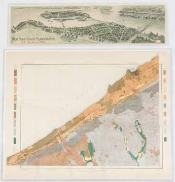
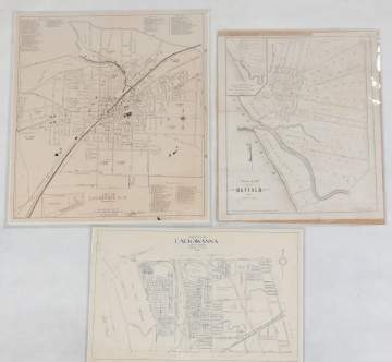
| US Department of Agriculture Soil Map, 1901 (22 1/2" x 29")'; New York Reservation at Niagara Guide, Courier Litho, Buffalo, NY (7 1/2" x 27 3/4"); Village of Buffalo Map, Lithograph 1804 (21 1/2" x 17 1/2"); City of Lackawanna, NY, 1936 (14 1/2" x 22"); City of Lockport, NY, 1941 (24" x 21"); Map of Tonawanda Harbor, 1837, Niagara River (39" x 35"); Plan de la Ville De Quebec, 1720 (14" x 17"); Survey of Ship's Canal around Niagara Falls, 1835 (19" x 47 1/2"); Map of Historic Niagara, 1891 (37" x 23"); and various other early maps. |
|
Provenance The Rochester Historical Society. |
|
Auction Date Dec 05, 2018 |
| Estimate: $200-$400 |
Shipping Information:
Unlike many auction companies, Cottone Auctions offers a full-service shipping department. We’re equipped to pack and safely ship just about any item to just about any location around the globe.
Learn more >